In the context of various transport routes alongside infrastructure projects under deterioration coupled with erosion hindering travel and production, local authorities are prioritizing resources to repair areas posing safety risks.
In early October, an anti-erosion embankment along with stream realignment project in Lieng Keh village, Dak Phoi commune was launched. Funded by the central government, the project has a total investment of 9.7 billion VND. Previously, prolonged heavy rainfall caused severe erosion along the stream in Lieng Keh village, altering its flow in conjunction with threatening to encroach upon the only access road together with nearby residential areas. During the rainy and storm season, the situation has seriously hampered travelling as well as transporting agricultural products, posing significant risk to traffic safety.
The project design includes the sturdy concrete embankment construction to prevent erosion, combined with the stream realignment. These measures aim to stabilize the local terrain, protect the road surface, minimize the erosive impact of the water flow during flood seasons. The construction is expected to take approximately three months, with completion in coordination with operation slated for the end of this year.
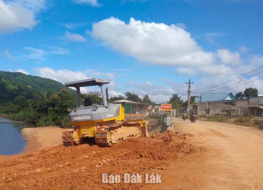 |
| Construction work on a project to reinforce anti-erosion embankments and realign a stream in Lieng Keh village, Dak Phoi commune. |
Mr. Y Nieng Luk, a resident of Lieng Keh village, shared that his house is located right next to the eroded area; consequently, his family has lived in constant anxiety during every rainy season, fearing that the land might continue to subside toward their house. With the embankment alongside stream-realignment project now underway, he together with his fellow villagers are very encouraged while looking forward to the project’s timely completion and entry into service.
Beyond prioritizing repairs to areas affected by natural disasters, several localities are proactively allocating budget resources to address traffic locations characterized by complex terrain coupled with limited visibility, frequently causing traffic accident risks.
For instance, Dur Kmal communal authority have allocated 400 million VND to install traffic safety infrastructure along the Buon Krong mountain pass, spanning approximately 1.5 km, connecting the villages of Krang combined with Krong, Dur Kmal commune. Although the route has been paved with concrete, while the road surface is approximately 5.5 meters wide, it features numerous steep sections in conjunction with sharp curves; more critically, in some locations on the down-slope side, lying a deep abyss, are still lacking guardrails.
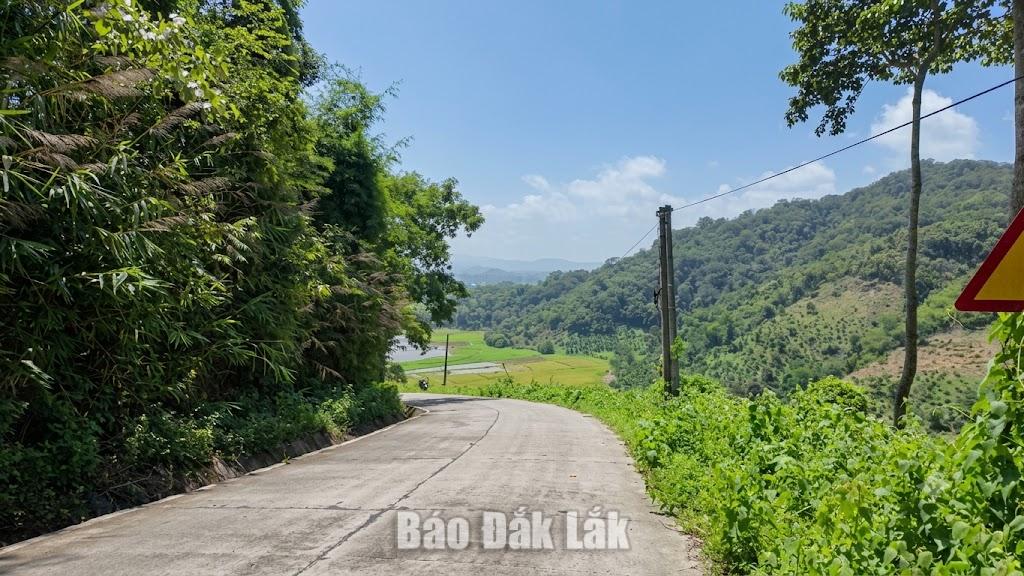 |
| The Buon Krong pass in Dur Kmal commune featuring steep terrain and obstructed visibility, posing a potential risk to traffic accidents. |
According to the Department of Construction, the province currently encompasses 10 national highways (totaling over 1,023 km), 23 provincial roads (654 km), more than 5,800 km of commune-level roads. Over 98% of the national along with provincial highways have been paved with asphalt or concrete, every commune now has road access to its center, largely satisfying the travel needs for the local population. Nevertheless, most routes have deteriorated due to long-term exploitation, limited maintenance funding, flood impact, while the demand for road upgrades in coordination with further construction remains high. Therefore, it is essential to continue prioritizing resources on the maintenance, repair, restoration for damaged or landslide-affected sections, as well as for the additional safety infrastructure installation, to ensure smooth traffic flow, facilitate travelling alongside goods transportation.
Translated by TRINH THUY